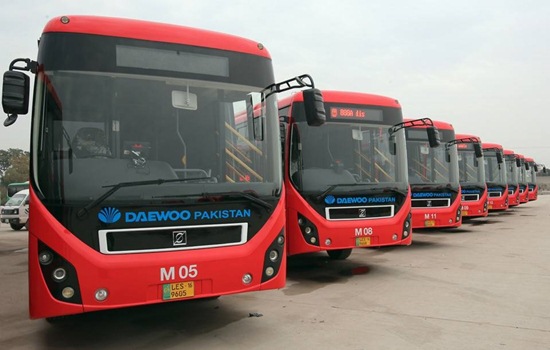
The Multan Metro route is 18.5 kilometres (11.5 mi) long, with 12.5 kilometres (7.8 mi) elevated section. It has 21 bus stations, with 14 elevated stations and seven ground level stations. 29 billion for 18.5 kilometres (11.5 mi), making it Rs 1.61 billion per Kilometer. Multan Metro is a bus rapid transit (BRT) system in Multan, Punjab (Pakistan). It has an 18.5km long route with 21 bus stations. Initially, Multan Metro was started with 47 buses while 10 buses were sent to the Lahore Metro later on. Afterward, more than 100 buses were deputed as feeder buses. These buses are called Multan Speedo Feeder Buses and brought passengers from and to far-flung areas from Metro Bus Stations.Multan Metro Bus System Route Map and Stations List. Multan Metro Bus Route Map and Stations List
Multan is one of the most populated cities of Pakistan and 3rd largest city of Punjab province of Pakistan.
Multan Metro Bus Route Map Ticket Counter and Stations List
Multan Metro Bus Stations List
List of all 21 metro bus stations in Multan is given below:- Bahauddin Zakariya University (BZU) Terminal
- Bahadarpur
- Mehmood Kot
- Northern Bypass
- Shalimar
- Sabzazar
- Chungi 6
- Gulgasht
- Chungi 9
- Qasim Fort
- Bab-e-Dolat
- Hafiz Jamal
- Manzoorabad
- Ahmedabad
- BCG Chowk
- Peoples Colony
- Vehari Chowk
- Multan General Bus Stand
- Jinnah Bagh
- Shah Rukn-e-Alam
- Kumharanwala Chowk Terminal
Speedo Bus Routes in Multan List
Speedo Buses are a network of feeder buses which are connected to main Multan Metro Bus Service. These feeder buses run on 13 different routes across Multan. Details list of these routes is shown in the following image.


